Our most recent tour of St. Louis bicycle infrastructure, following bike maps and signage, took us to western and southern St. Louis.

Street scene along South Broadway Avenue, a designated bicycle route.
Riding bicycle lanes along Holly Hills Boulevard adjacent to Carondelet Park.
Starting in The Grove, we rode west on Manchester road. This road is currently being repaved and will soon feature bicycle lanes and sharrows, a welcome addition to this two-lane road which has relatively low volume but high speed traffic. In Maplewood, we followed the bike route marked by sharrows and signs down Sutton and Greenwood; the route was poorly marked here and easy to lose.
Our ride began on Manchester Road, found its way to River des Peres via Maplewood, continued to South Broadway along the river, and returned to South City by way of Carondelet Park. View the route in a larger map (you can then see bike routes by selecting Bicycling option in Traffic dropdown in upper right corner)
Our aim was to get from Maplewood to the River des Peres bike path, but there is no “official” bike route to do so; we proceeded on Big Bend, Shrewsbury, and Landsdowne avenues, passing freeway ramps and large intersections along hilly multi-lane roads. Traffic was light and we had no significant problems, but this is not a route I’d choose to take during commute hours. This stretch in particular illustrated the limits of relying on our current bicycle infrastructure to find bike-friendly routes and avoid hazardous sections.
The next section of our route was on a separated bicycle path along and west of the River des Peres Boulevard. This path, in spite of its bumpy, sometimes narrow pavement and frequent street crossings, is quiet, shaded in places, and altogether enjoyable. On its southern end the trail continues on the eastern side of the river; not realizing this, we continued along River des Peres Blvd and ended up riding on a two lane road with relatively busy traffic when the path soon ended. We continued on River City Casino Blvd to northbound South Broadway.
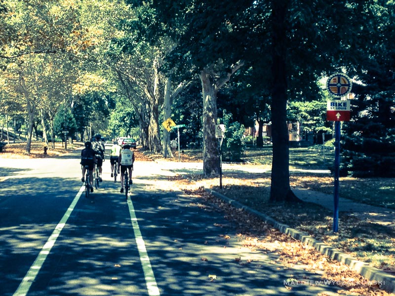
South Broadway is a designated bicycle route with sharrows along this stretch. It is wide with relatively light traffic and surprisingly lively stores and pedestrian sections. We turned left on Holly Hills and proceeded up the short steep hill, with views of the river making up for the hot climb. The nicest part of the ride was along Holly Hills and Christy Boulevards, where dedicated bicycle lanes lie along tree-lined streets next to Carondelet park and elegant neighborhoods.
All this comes to an abrupt end as Christy Boulevard merges into busy South Kingshighway. Here the designated lane heads east but we needed to go north, and missed the earlier left turn (never saw the sign). We crossed Kingsighway at a complicated Y intersection; not too bad in light traffic, but definitely a weak spot in route connectivity and signage. The ride up the sharrow-marked Macklind avenue to Arsenal was pleasant and uneventful. At Arsenal and Kingsighway, rather than riding along busy Kingshighway for a block, we crossed that busy road and doubled back on side streets to arrive at The Royale, our final destination.
The ride was about 20 miles and took a leisurely two hours, with Katie, Debbie, Stacy, Brett, and Matt joining us.
Leave a Reply